Discussion Questions Based On Bloom's Taxonomy
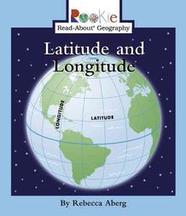
Latitude and Longitude by: Rebecca Aberg (Non-Fiction)
1. Analysis: Compare and contrast the terms latitude and longitude.
2. Evaluation: What do you think is the purpose of the lines that you can find on the map or globe?
3. Knowledge: Looking at the map on page 6, locate the coordinates of Eagle Cliffs?
4. Knowledge: Looking at the map on page 6, locate the coordinate of Cougar Mountain.
5. Knowledge: Define the term equator.
6. Evaluation: What is significant about the Prime Meridian compared to the other lines of longitude?
7. Analysis: Compare and contrast the Prime Meridian to the Equator.
8. Comprehension: Paraphrase the reason given by the book that explores used the lines on the globe.
9. Application: Construct your own globe on the foam spheres provided. Include and label the equator, Prime Meridian, northern hemisphere, southern hemisphere, longitude and latitude lines.
10. Synthesis: Produce a list of people who may benefit from latitude and longitude lines on the world map.
11. Comprehension: What is an example of an object that is a sphere? What is an example of an object than is a hemisphere.
12. Comprehension: How does the equator distinguish two of the hemispheres?
13. Synthesis: Construct a game using the globe that you could play to help practice longitude and latitude.
14. Application: Invent your own continent on the map and provide its location. Include the hemisphere it’s located in as well as its coordinates.
15. Knowledge: Where are two places that the longitude lines intersect?
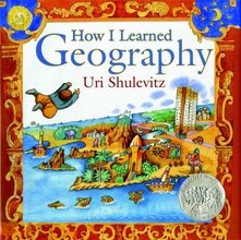
How I Learned Geography by: Uri Shulevitz (Fiction)
1. Knowledge: State the reason why the family had to flee their house?
2. Knowledge: Describe the living and weather conditions that the family moved into.
3. Evaluation: What do you think was the influence of the map on this little boy’s life?
4. Synthesis: Create a rhyme based on what you can find on the map like the little boy did in the story.
5. Application: Produce the sequence of events throughout the boy’s journey.
6. Synthesis: Construct your own journey through places that can be found on the globe. Describe the location and the weather of the places you choose.
7. Evaluation: Compare the little boys feelings of the map in the beginning of the story to the end of the story.Why did his view change?
8. Comprehension: Summarize the story in 3 sentences.
9. Application: Paint your favorite scene from the book. Add your own creativity.
10. Evaluation: Critique the positives and negatives of the father buying the map.
11. Comprehension: Defend the father and his reason behind spending the little money they had on the map rather than food.
12. Analysis: Point our 5 objects from the last two pages in the book and explain their significance. Be creative in your explanations.
13. Knowledge/Comprehension: Define the term bazaar based on the picture it is used in.
14. Application: Organize a timeline to display where the Author lived throughout his life. Use the Authors note on the last page of the book.
15. Application: Produce a map similar to the authors at the end of the book, using only your memory and knowledge of the world.
*This link will take you to a word document of the above questions.
CCSS.ELA-LITERACY.RI.3.7 - Use information gained from illustrations and the words in a text to demonstrate understanding of the text.
Other Useful Books Include:
Fiction Books
Teacher Resources
Fiction Books
- Mapping Penny's World Author: Loreen Leedy
- Treasure Island Author: Robert Lewis Stevenson
- The Scrambled States of America Author: Henry Holt
- A World of Wonders; Geographic Book in Verse and Rhyme Author: Patrick J. Lewis
- Looking at Maps and Globes Author: Carmen Bredeson
- Explore Earth's Seven Continents Author: Bobbie Kalman
Teacher Resources
- 25 Map Crosswords: Ready-to-go reproducible maps with crossword puzzles to teach key geography skills Author: Spencer Finch
- Exploring Our World With Maps Author: Haig Rushdoony
- Children and Their World: Strategies for Teaching Social Studies Author: David Welton
Database Discussion Questions
Watch the short video, “Maps and the Globe,” from Discover Education Streaming. Below are discussion questions based on the video. http://app.discoveryeducation.com/search?Ntt=latitude+%26+longitude
1. Compare and contrast maps and globes. (Analysis)
2. Explain purpose of a symbol on a map? (Comprehension)
3. Draw your own map and make a key. In the key use symbols for different places on your map including: mountains, rivers, lakes, train tracks, cities and roads. (Application)
4. What is the difference between latitude and longitude lines? (Comprehension)
5. What is an easy way, that the video state, to direct someone to the city they want to go to on a map? (Knowledge)
6. Define the term region.(Knowledge)
7. Why do you think the world is separated into regions? (Knowledge)
8. Come up with a list of similar characteristics that you think different regions may have? (Application)
9. Justify the reasons you believe that people around the world live differently, for example their geography.(Evaluation)
10. Summarize the main points of the video in 4 sentences.(Evaluation)
Another useful database:
Brain Pop - brainpop.com
CCSS.ELA-Literacy.RI.3.1 - Ask and answer questions to demonstrate understanding of a text, referring explicitly to the text as the basis for the answers.
1. Compare and contrast maps and globes. (Analysis)
2. Explain purpose of a symbol on a map? (Comprehension)
3. Draw your own map and make a key. In the key use symbols for different places on your map including: mountains, rivers, lakes, train tracks, cities and roads. (Application)
4. What is the difference between latitude and longitude lines? (Comprehension)
5. What is an easy way, that the video state, to direct someone to the city they want to go to on a map? (Knowledge)
6. Define the term region.(Knowledge)
7. Why do you think the world is separated into regions? (Knowledge)
8. Come up with a list of similar characteristics that you think different regions may have? (Application)
9. Justify the reasons you believe that people around the world live differently, for example their geography.(Evaluation)
10. Summarize the main points of the video in 4 sentences.(Evaluation)
Another useful database:
Brain Pop - brainpop.com
- After logging in, type "Latitude and Longitude" into the search bar
- Choose the video "Map Skills," this is a video by Tim and Moby that the students will absolutely love!
- After watching the video, have the students discuss when in their lives they have had to use a map.
CCSS.ELA-Literacy.RI.3.1 - Ask and answer questions to demonstrate understanding of a text, referring explicitly to the text as the basis for the answers.
Website Discussion Questions
1) This is a link to National Geographic's "Introduction to Latitude and Longitude."
http://education.nationalgeographic.com/education/activity/introduction-latitude-longitude/?ar_a=1
To answer the following questions click on the world map.
1. Why do you think that there are lines running up and down the page? What is the purpose of them? (Evaluation)
2. Do these lines actually exist or are the imaginary? Explain. (Comprehension)
3. Using your knowledge of north, south, east, and west which way do the latitude lines run? What way do the longitude lines run? (Knowledge)
4. Examine the degrees of latitude and longitude as well as the patterns of numbers as you move away from 0, what do you notice? (Analysis)
5. Zoom into North America.Locate the coordinates of the lines intersecting in the middle of the continent, what are they? (Comprehension)
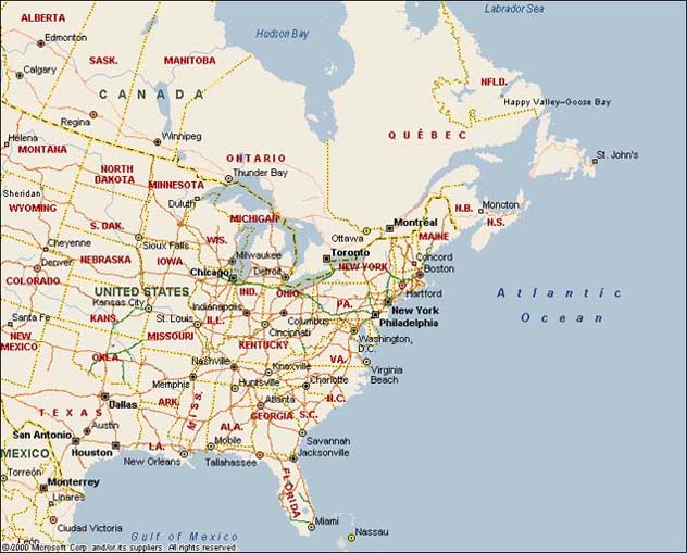
To answer the following questions click on the map of the United States.
1. Examining the line 40°N, what are 5 states that this line crosses over? (Analysis)
2. Point out the coordinates of the longitude and latitude lines that cross in Texas. (Analysis)
3. Using the scale on the top of the map and a ruler, how many miles is it from San Francisco to Denver? (Application)
4. Judge what you think you should do if the location of a town is in between lines and not right on the line? (Evaluation)
5. Do you think it would be hard to find a location on the globe without having the coordinates to find it? Explain why or why not. (Comprehension)
Another great website:
ABCya.com - http://www.abcya.com/latitude_and_longitude_practice.htm
- There is a longitude and latitude game at this link that will be great practice for your students!
CCSS.ELA-LITERACY.RI.3.7 - Use information gained from illustrations and the words in a text to demonstrate understanding of the text.
Primary Documents
1) http://www.lib.utexas.edu/maps/historical/shepherd/british_colonies_1763-76.jpg
· This is an old map (1763-1775) of the British Colonies of North America
· The map contains points of latitude and longitude
· It also has a key and a scale
2) http://www.uta.edu/library/k12/lessons/diary-files/diary-map.gif
· This is a map of Texas from 1864
· The map contains points of latitude and longitude
· It also has a scale
*This link will take you to a word document for the websites, databases, and primary documents shown above.
CCSS.ELA-Literacy.RI.3.9 - Compare and contrast the most important points and key details presented in two texts on the same topic.
· This is an old map (1763-1775) of the British Colonies of North America
· The map contains points of latitude and longitude
· It also has a key and a scale
- Below is a link to a map of Eastern North America today that the students can use to compare to the map of the British Colonies in 1763, above.
- http://2.bp.blogspot.com/_VLS94oj0rVc/TPL2XviSHYI/AAAAAAAAADI/erecP9XvmqY/s1600/of-north-america+%25284%2529.jpg
2) http://www.uta.edu/library/k12/lessons/diary-files/diary-map.gif
· This is a map of Texas from 1864
· The map contains points of latitude and longitude
· It also has a scale
*This link will take you to a word document for the websites, databases, and primary documents shown above.
CCSS.ELA-Literacy.RI.3.9 - Compare and contrast the most important points and key details presented in two texts on the same topic.
